Category:Christuskirche (Bad Vöslau)
Jump to navigation
Jump to search
| Object location | | View all coordinates using: OpenStreetMap |
|---|
church building in Bad Vöslau, Austria .JPG) | |||||
| Upload media | |||||
| Instance of | |||||
|---|---|---|---|---|---|
| Named after | |||||
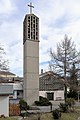
| Location | Bad Vöslau, Baden District, Lower Austria, Austria | ||||
| Street address |
| ||||
| Heritage designation | |||||
 | |||||
Media in category "Christuskirche (Bad Vöslau)"
The following 4 files are in this category, out of 4 total.
-
 Bad Vöslau - Christuskirche (1).JPG 2,834 × 4,252; 9.56 MB
-
 Bad Vöslau - Christuskirche (2).JPG 3,484 × 2,656; 9.87 MB
-
 Bad Vöslau - Christuskirche (3).JPG 3,719 × 2,481; 9.81 MB
-
 Evangelische Kirche Raulestr 5 Bad Voeslau.jpg 4,027 × 2,685; 8.66 MB
.JPG)
.JPG)
