Category:Pfarrkirche Wippenham
Jump to navigation
Jump to search
| Object location | | View all coordinates using: OpenStreetMap |
|---|
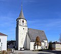
| This category shows the protected monument with the number 60273 in Austria. (Commons, de, Wikidata) |
church building in Wippenham, Austria .JPG) | |||||
| Upload media | |||||
| Instance of | |||||
|---|---|---|---|---|---|
| Location | Wippenham, Ried District, Upper Austria, Austria | ||||
| Heritage designation | |||||
 | |||||
Subcategories
This category has only the following subcategory.
I
Media in category "Pfarrkirche Wippenham"
The following 12 files are in this category, out of 12 total.
-
 Katholische Pfarrkirche Mariä Namen Wippenham Ansicht von Nordwesten.jpg 5,772 × 3,247; 10.81 MB
-
 Katholische Pfarrkirche Mariä Namen Wippenham Ansicht von Süden.jpg 6,304 × 4,503; 18.61 MB
-
 Katholische Pfarrkirche Mariä Namen Wippenham Ansicht von Südosten.jpg 6,875 × 4,910; 19.01 MB
-
 Katholische Pfarrkirche Mariä Namen Wippenham Gotisches Südportal.jpg 3,830 × 5,362; 15.47 MB
-
 Wippenham - Kirche (1).JPG 3,150 × 2,799; 5.78 MB
-
 Wippenham - Kirche (2).JPG 3,150 × 2,100; 5.15 MB
-
 Wippenham - Pfarrkirche - 01.jpg 2,721 × 3,469; 3.87 MB
-
 Wippenham - Pfarrkirche - 02.jpg 3,144 × 2,864; 2.48 MB
-
 Wippenham - Pfarrkirche - 03.jpg 2,736 × 3,396; 3.45 MB
-
 Wippenham - Pfarrkirche - 04.jpg 3,819 × 3,000; 3.06 MB
-
 Wippenham - Pfarrkirche - 06.jpg 3,997 × 1,886; 2.54 MB
-
 Wippenham Kriegerdenkmal an der katholischen Pfarrkirche Mariä Namen.jpg 4,724 × 3,375; 15.75 MB


.JPG)


