Category:Pfarrkirche Altmünster
Jump to navigation
Jump to search
| Object location | | View all coordinates using: OpenStreetMap |
|---|
church in Altmünster, Austria   | |||||
| Upload media | |||||
| Instance of | |||||
|---|---|---|---|---|---|
| Location | Altmünster, Gmunden District, Upper Austria, Austria | ||||
| Street address |
| ||||
| Diocese | |||||
| Heritage designation | |||||
 | |||||
Subcategories
This category has only the following subcategory.
I
Media in category "Pfarrkirche Altmünster"
The following 13 files are in this category, out of 13 total.
-
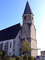
 Altmünster - Kirche.JPG 3,898 × 2,821; 9.45 MB
-
 Altmünster Kirchenfenster-2474.jpg 3,063 × 4,603; 11.48 MB
-
 Altmünster Kruzifix an Pfarrkirche.jpg 1,601 × 2,627; 1.24 MB
-
 Altmünster Pfarrkirche hl. Benedikt 1413.JPG 3,264 × 2,448; 1.58 MB
-
 Altmünster Pfarrkirche hl. Benedikt 1414.JPG 3,264 × 2,448; 1.54 MB
-
 Altmünster Pfarrkirche hl. Benedikt 1415.JPG 2,448 × 3,264; 1.52 MB
-
 Altmünster St. Benedikt Grabsteine 714.jpg 4,707 × 3,138; 12.13 MB
-
 Altmünster St. Benedikt Turm 715.jpg 4,855 × 3,237; 16.49 MB
-
 Altmünster St.Benedikt - Epitaph.jpg 2,560 × 1,920; 3.18 MB
-
 Altmünster St.Benedikt - Kirchturm.jpg 1,920 × 2,560; 2.48 MB
-
 Altmünster St.Benedikt - Portal.jpg 2,560 × 1,920; 2.16 MB
-
 Pfarrkirche Altmünster, 2012.jpg 4,608 × 3,456; 3.41 MB
-
 Pfarrkirche Altmünster.JPG 2,802 × 2,067; 2.22 MB


