Category:Pfarrkirche hl. Nikolaus, Kobersdorf
Jump to navigation
Jump to search
| Object location | | View all coordinates using: OpenStreetMap |
|---|
cemetery in Burgenland, Austria  | |||||
| Upload media | |||||
| Instance of | |||||
|---|---|---|---|---|---|
| Named after | |||||
| Location | Kobersdorf, Oberpullendorf District, Burgenland, Austria | ||||
| Street address |
| ||||
| Architectural style | |||||
| Heritage designation | |||||
 | |||||
Media in category "Pfarrkirche hl. Nikolaus, Kobersdorf"
The following 12 files are in this category, out of 12 total.
-
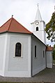
 Kobersdorf - katholische Kirche.JPG 1,393 × 1,969; 2.41 MB
-
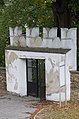 Kobersdorf-Pfarrkirche altes Eingangstor.jpg 3,264 × 4,928; 2.69 MB
-
 Kobersdorf-Pfarrkirche Ansicht links mit Mauer.jpg 4,928 × 3,264; 4.19 MB
-
 Kobersdorf-Pfarrkirche Grabtafel an der Mauer.jpg 3,264 × 4,928; 3.64 MB
-
 Kobersdorf-Pfarrkirche Hintereingang Sakristei.jpg 3,264 × 4,928; 2.01 MB
-
 Kobersdorf-Pfarrkirche links hinten.jpg 3,264 × 4,928; 2.4 MB
-
 Kobersdorf-Pfarrkirche links vorne.jpg 3,264 × 4,928; 1.63 MB
-
 Kobersdorf-Pfarrkirche rechts hinten.jpg 4,928 × 3,264; 1.99 MB
-
 Kobersdorf-Pfarrkirche rechts vorne.jpg 3,264 × 4,928; 1.68 MB
-
 Kobersdorf-Pfarrkirche Seiteneingang links.jpg 3,264 × 4,928; 2.61 MB
-
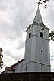
 Kobersdorf01.jpg 4,752 × 3,168; 5.07 MB
-
 Sieggrabener Kogel.jpg 7,330 × 3,703; 6.32 MB


